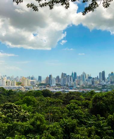


Boquete, located in the highest areas of the Chiriqui province, is a valley surrounded by green mountains and a very special destination for hiking lovers. Its trails take you through farms, jungles, and cloud forests, offering different landscapes with every step. Discover the colors of this beautiful district through these 11 trails we’ve selected for you.
1. Volcan Baru
3. The Pipeline Trail in Boquete
5. Piedra de Lino Trail: Along the Mountain Ridge
7. Exploring the Culebra Trail
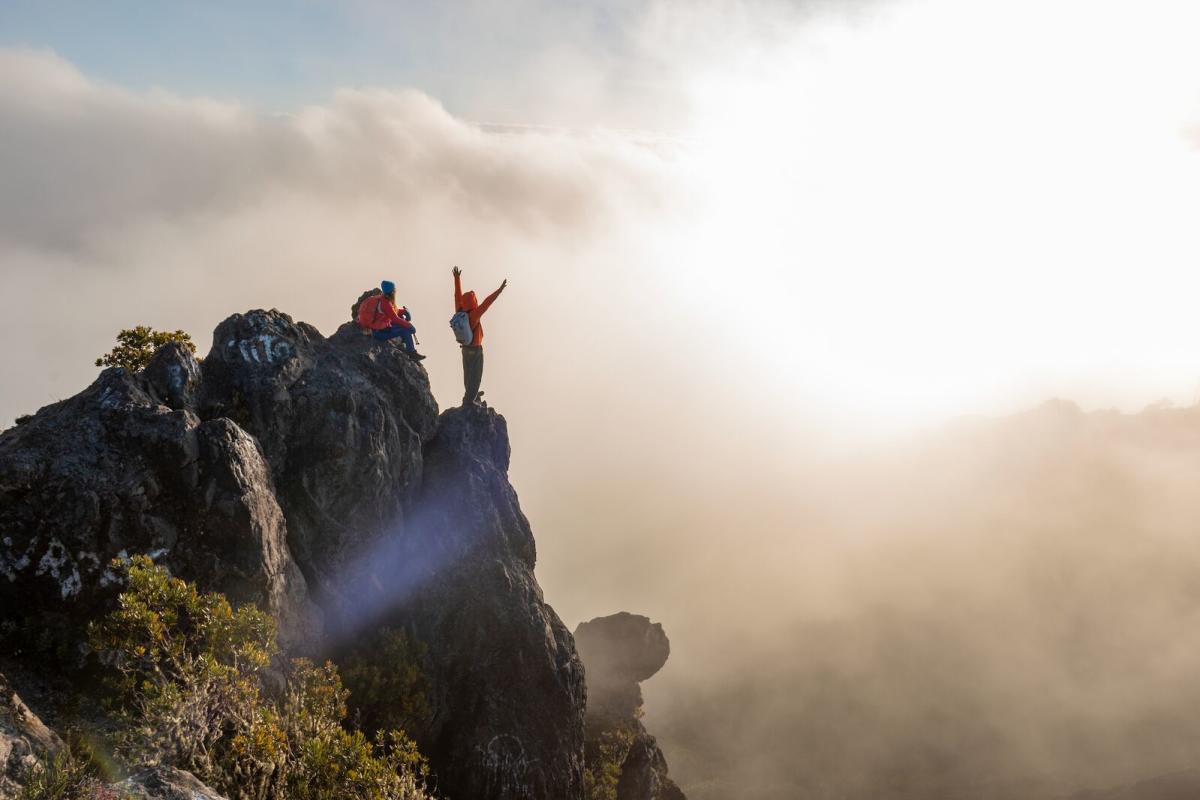
To reach the highest peak in the country from Boquete, it’s best to start your hike as early as possible. Volcan Baru National Park opens at 4 a.m., and it takes 6 to 8 hours to reach the summit.
At that time of day the wildlife is very active, so you'll be able to hear and spot many animals.
Around 250 bird species have been recorded on this route, along with many mammals, including 5 feline species. Both the summit and the trail offer unforgettable views. You can also hike to the top of Volcan Baru via the Los Llanos trail in Volcán, in the district of Tierras Altas.
Tips
-
This is one of the most physically demanding trails in the country; we recommend going with a guide and informing park authorities when entering.
-
Keep in mind that the park occasionally closes due to heavy rain.
-
There is a camping area near the summit where you can spend the night to watch the sunrise above the clouds.
-
Park entrance costs approximately US$5. Guided tours range from US$30 to US$150.
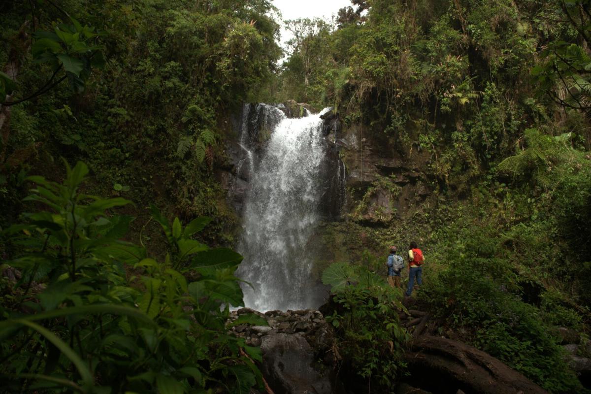
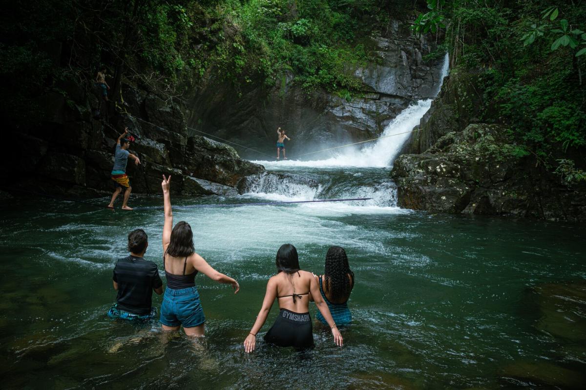
If you want to combine hiking with refreshing breaks, don’t miss this trail. The route connects three beautiful waterfalls, each accessible via short detours. Bring a swimsuit—two waterfalls have natural pools where you can take a dip and enjoy the scenery.
Tips
-
This is a dirt trail, and during the green season it gets muddy and slippery; wear shoes with good traction.
-
If the hike becomes too challenging, you can stop at the first waterfall or continue the main trail without taking the detours.
-
Entrance costs around US$7 if visiting on your own, or about US$38 with a guide.
3. The Pipeline Trail in Boquete
- Location: Bajo Mono
- Distance: 3.05 km (2 miles)
- Difficulty: Low to moderate
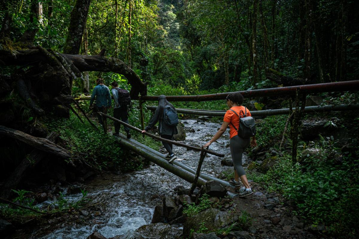
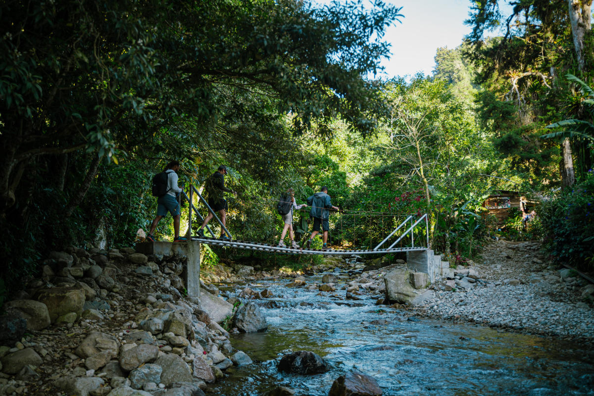
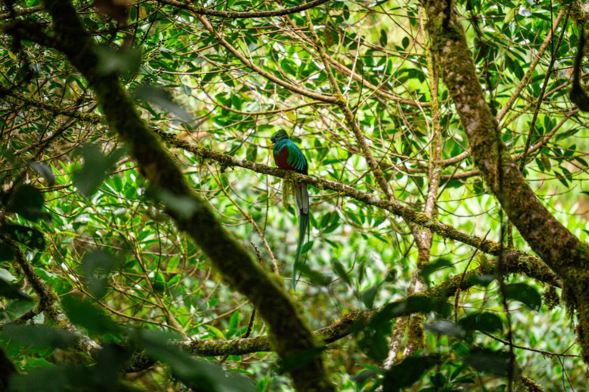
A flat, well‑marked trail perfect for families. It follows a river through natural forest all the way to an impressive waterfall. You’ll cross several bridges with views of the deep forest on either side. Take time to admire the massive 1,000‑year‑old tree halfway along the trail. Stay alert—you may spot howler monkeys, snakes, and with luck, the quetzal.
Tip
Entrance costs about US$3. We recommend joining a guided tour, which typically costs US$35 to US$40 per person as of early 2026.
With an elevation gain of over 600 meters (2,000 ft), this trail offers hillside views and takes you through dense cloud forest. Hike to the summit surrounded by a landscape full of life, where clouds and flowers meet.
Tip
This trail runs through wild and shifting terrain—always go with a certified guide who knows the area well. Avoid it during the green season, as the mud makes it very slippery. Follow all safety guidelines from guides and locals.
5. Piedra de Lino Trail: Along the Mountain Ridge
- Location: Los Naranjos
- Distance: 1.3 km (0.80 miles)
- Difficulty: Moderate to high
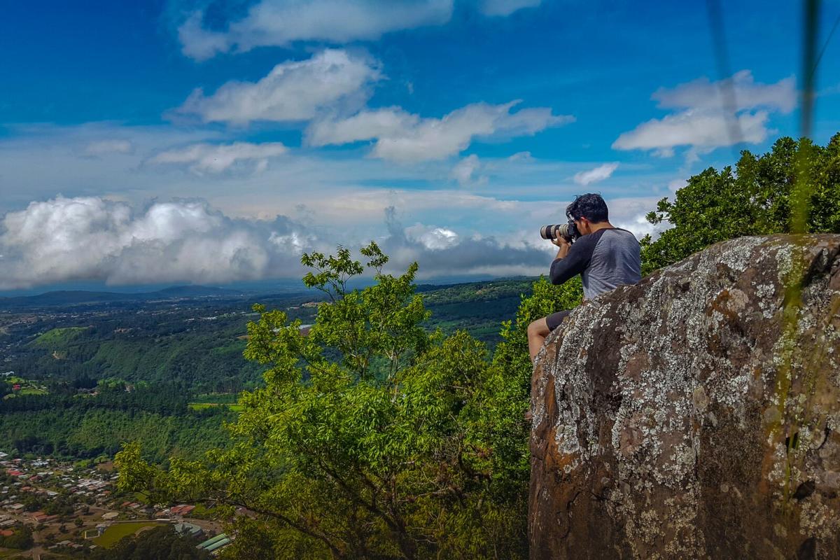
A short yet demanding trail with a 300‑meter ascent. Although the climb is tough, don’t skip the viewpoint—you’ll be rewarded with amazing views of Volcan Baru, Bajo Mono, and Boquete.
Tip
Wear hiking boots or shoes with good traction. The path can be steep and slippery. Go with a guide and, if the weather is ideal, stay for the sunset—you won’t regret it.
6. Los Quetzales Trail
- Location: Volcan Baru National Park, Bajo Mono
- Distance: 18.2 km (11.30 miles)
- Difficulty: Moderate
The Los Quetzales Trail connects two charming destinations: Bajo Mono and Cerro Punta in Tierras Altas.
Its most iconic viewpoint, La Roca, is halfway along. You can hike only the first 9.6 km (6 miles) to the viewpoint or complete the entire trail. You’ll see enormous trees with giant roots and vines, butterflies, insects, mammals, and birds.
If you continue the remaining 9 km (5.5 miles) beyond the hanging bridge, the hike becomes more challenging as you begin the ascent to Cerro Punta.
Tip
Check with authorities before planning your visit—the trail sometimes closes during the green season.
This trail ends in the district of Tierras Altas. You can coordinate luggage transfer if combining both destinations or return to Boquete the same day.
7. Exploring the Culebra Trail
- Location: Los Naranjos
- Distance: 4.43 km (2.75 miles)
- Difficulty: Low to high
Don’t let the name scare you—the trail is named for its winding, snake‑like shape, not actual snakes. This path is a paradise for flower lovers. In the cloud forest you’ll see moss‑covered terrains and trunks, orchids of all shapes and colors, several fern species, and plants like leafy liverworts.
Tip
For an unforgettable experience, hike with a specialized guide who can explain the rich biodiversity around you. Tours cost about US$35 per person as of early 2026.
8. The Epic Journey to Piedra de la India Vieja
- Location: Jaramillo
- Distance: 7 km (4.34 miles)
- Difficulty: High
This trail takes you to a rocky mountain ridge with one of Boquete’s best views. It’s a steep climb through wild terrain. Though challenging, the viewpoint known as La Piedra (The Rock) is absolutely worth it. Walk along the mountain edge surrounded by incredible scenery—ideal for nature connection and photos.
Tip
The trail is not well marked, so it’s essential to go with a certified guide who knows the route and has all necessary safety resources.
This waterfall is easy to reach, located near the Vía Chiriquisito road. As you approach, you'll see unique giant boulders from the car and along the short path. At the waterfall, climb up to the upper pool for a view of the 8‑meter drop.
This is a pure adrenaline spot—many visitors jump from the rocks into the crystal‑clear natural pool.
Tip
The waterfall is within Ngäbe territory, so you must book through the community leaders who manage the activity. Beyond the hike and the waterfall, visiting Jä Gwätä is a great opportunity to learn about the community, their culture, crafts, and traditional food.
10. The Mossy Rock Trail
- Location: Jaramillo
- Distance: 3 km (1.8 miles)
- Difficulty: Moderate
This trail leads to a beautiful viewpoint overlooking the Boquete valley. The first part runs through rural landscapes with farms, horses, and cows. The trail then enters primary forest and later a wilder tropical jungle.
Along the way you’ll find the famous abandoned car in the middle of the forest—a perfect movie‑like photo spot.
From the top, enjoy panoramic views and colorful flora, including mosses, flowers, and fungi along the path.
11. The Lady of the Mountain
- Location: Los Naranjos
- Distance: 2.25 km (1.40 miles)
- Difficulty: Moderate
Start this trail in an open field surrounded by Boquete’s mountains. Then continue through giant trees along an open path ideal for birdwatching. You may find finches, tanagers, hummingbirds, nightingales, trogons, toucanets, and woodpeckers.
Next, the trail enters deep cloud forest, perfect for spotting orchids and medicinal plants.
It ends at La Dama de la Montaña, a 15‑meter‑high waterfall whose beauty gives the place a sacred feeling. Tradition says you should take a dip in the icy pool—are you brave enough?
Tip
Because of the cold climate and water temperature, the dip is truly freezing. Bring warm clothes and a change of clothes for the way back.
Boquete
Where to stay in
