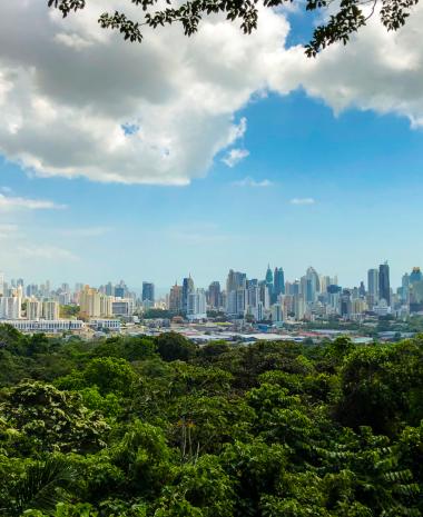


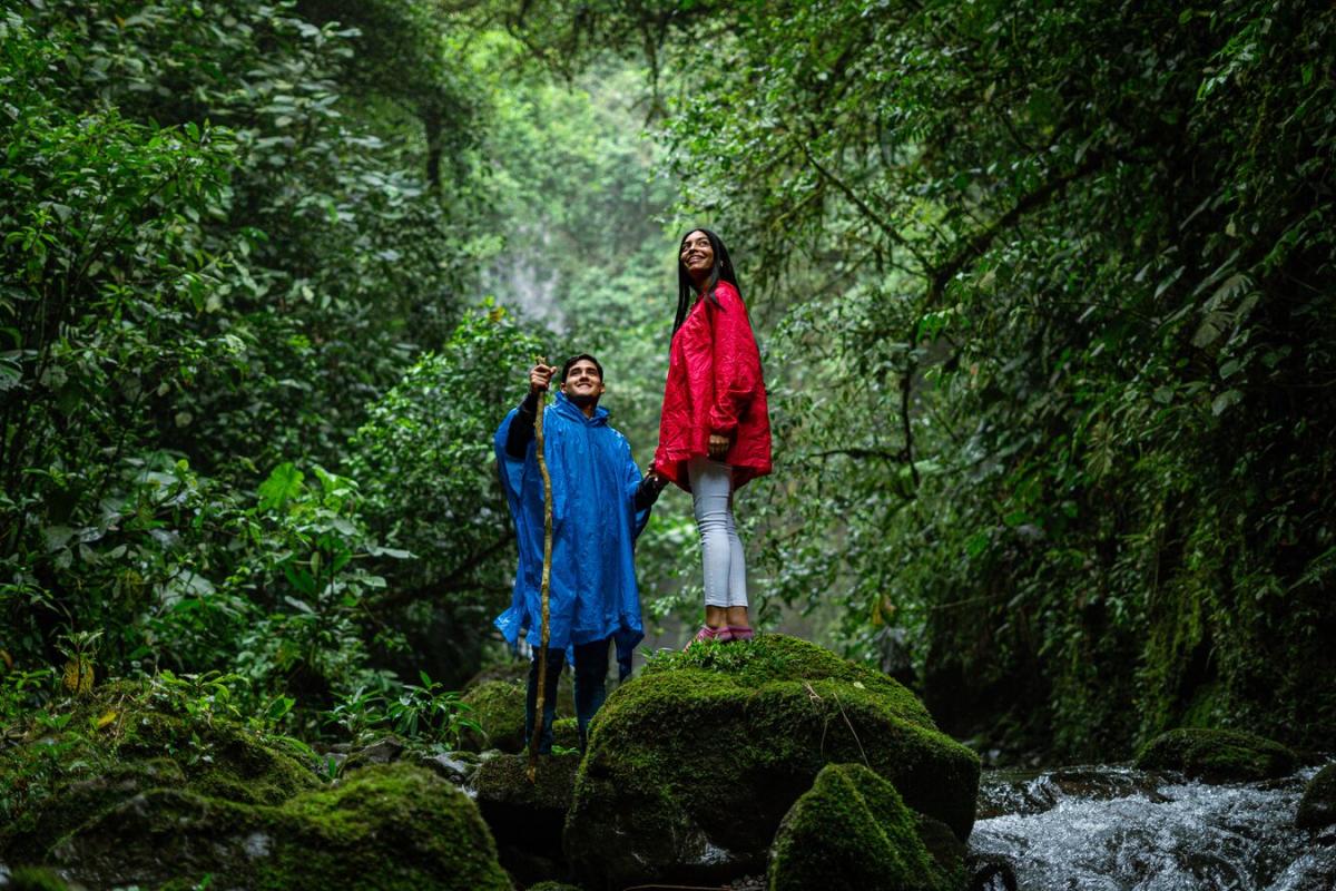
Tierras Altas, in the province of Chiriqui, is an incredible destination for those who love walking through nature and challenging themselves along the way.
Its mountains are crossed by trails with ascents and descents that vary depending on the route you choose. Hike toward magnificent waterfalls, lush vegetation, and stunning views. Explore its paths, climb its mountains, and discover the different microclimates that give life to immense biodiversity. Do it by following this list of 11 routes for hikers of all levels.
6. Ascent to Cerro Punta from Entre Rios
1. Ascent to Volcan Baru
- Location: Volcan Baru National Park
- Distance: 13.5 km (8.3 miles)
- Difficulty: High
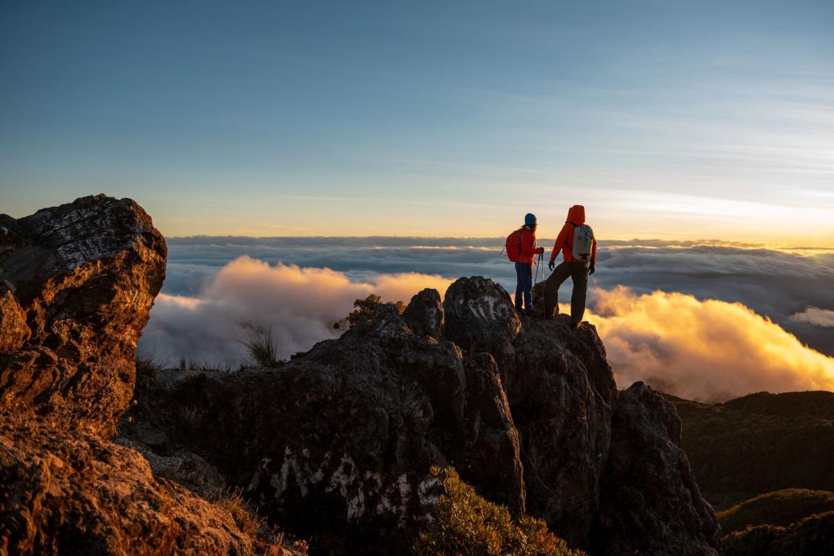
In Tierras Altas you’ll find the shortest and most challenging trail to reach the summit of Volcan Baru, the highest point in Panamá. The ascent takes approximately 6 to 8 hours, and you must do it with a specialized guide. You’ll reach one of the best viewpoints in the country. As you climb, you’ll notice how the vegetation changes—from montane humid forest to lower forests; a unique combination in the country.
Upon reaching the summit, at 3,475 masl (11,410 ft), you’ll enjoy unmatched panoramic views, sunrises above the clouds, and on clear days, you can even see both oceans from the same point!
To catch the sunrise, you have two options: start your ascent at night and reach the top with the first rays of sunlight, or climb during the day, sleep in the camping area, and wake up to the sunrise. Along the way, you’ll see all kinds of birds, felines, monkeys, and rodents.
Tip
Temperatures range from 20°C to 10°C (68°F to 50°F), and at dawn they may drop to 0°C (32°F). Pack light layers you can put on and take off easily.
Remember, this is a protected area—do not touch or feed the animals, and take care of the environment and yourself.
2. Panamá Verde Trail
- Location: La Amistad International Park, Las Nubes
- Distance: 400 m (1,312 ft)
- Difficulty: Easy
A short, flat trail inside a vast protected forest. La Amistad International Park (PILA) has hosted scientists and nature lovers for years, all studying the life within the forest.
On this trail, you and your family can enjoy walking through a small portion of the park and learning about the secondary forest. Take the opportunity to look for wildlife such as monkeys, butterflies, and birds.
Tip
This trail is well-marked and does not require a guide; still, we suggest visiting the interpretation center to learn about the important forest you're about to explore.
3. El Retoño Trail
- Location: La Amistad International Park, Las Nubes
- Distance: 2.4 km (1.49 miles)
- Difficulty: Easy
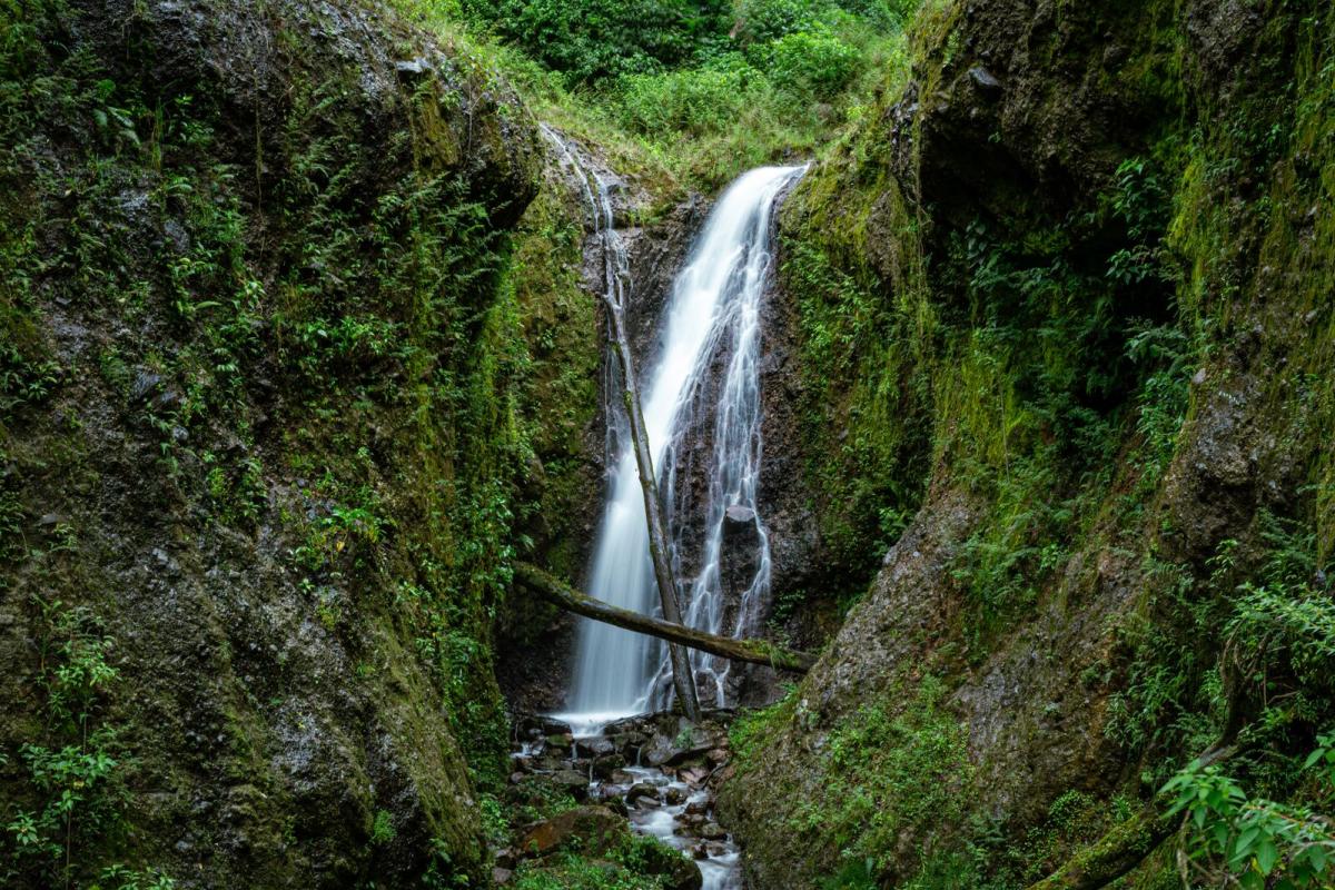
Another ideal trail for the whole family. It is quite flat and short, so you can complete it and continue your day with another activity. The most fun part of this trail is crossing two rivers: the first by hopping from stone to stone, and the second by walking across a log that connects both banks.
Walk attentively—the trees are covered in orchids, ferns, and mushrooms and provide shelter to various bird species. You might spot a quetzal or hear its call as you walk.
Tip
Wear appropriate shoes for stepping on stones, and be very careful while doing it.
4. La Cascada Trail
- Location: La Amistad International Park, Las Nubes
- Distance: 6 km (3.73 miles)
- Difficulty: Medium
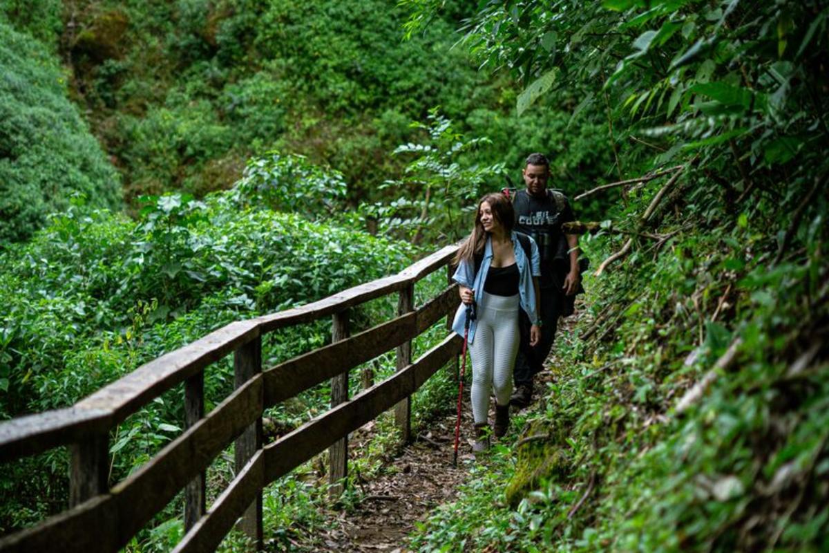
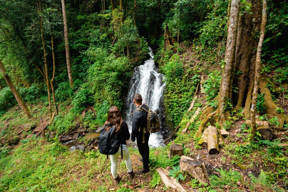
This is the most complete and challenging trail in this area. It begins at the Las Nubes interpretation center, is steep, and more than half of the route is uphill. As you gain altitude, you’ll enjoy the abundant flora and fauna of the park.
When you reach the top, you’ll arrive at La Nevera, a truly special spot where you can feel the condensation of the clouds on the gigantic trees.
After that, the descent begins toward the viewpoint and the waterfall. The water is cold, but the experience is incomparable. Even if you decide not to swim, you’ll still be rewarded with spectacular, photo‑worthy views.
Tip
Although the trails are well‑marked and recently restored, it’s best to visit with a guide—this way you’ll make the most of the experience and more easily spot wildlife.
Remember, this is one of the last refuges of Central America’s big cats. Walking through PILA means visiting a UNESCO World Heritage Site due to its immense biodiversity.
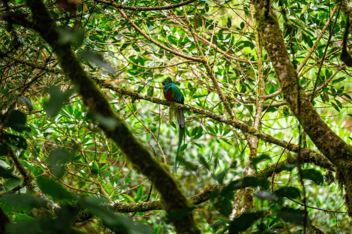
This trail connects two important mountain destinations in Panamá: Cerro Punta and Boquete. It is famous because it is home to the quetzal, the mythological bird of the region’s Indigenous peoples. Walk with a specialized guide who will help you spot some of the many quetzal pairs counted in the park’s branches.
Los Quetzales is long but relatively easy—a perfect challenge if you enjoy walking without needing intense training. Another advantage of starting in Cerro Punta is that the trail is mostly downhill.
The trail runs primarily through dense cloud forest. Keep your eyes up—you may spot monkeys and different bird species.
Tip
Although you can visit year‑round, between February and June you’ll have a better chance of seeing quetzals, as it’s their mating season and you might even spot chicks.
The trail ends in Boquete, another destination you’ll love. If you complete the full trail, you don’t need to return to the starting point; you can book a hotel and a service to move your luggage while you walk through the forest.
6. Ascent to Cerro Punta from Entre Rios
- Location: Cerro Punta
- Distance: 4 km
- Difficulty: High
Starting with a 45° incline, this is one of the most challenging trails in the region. Depending on your physical condition, you may need to stop several times—use the breaks to breathe fresh air and spot wildlife in the trees.
The path is lined with flora typical of tropical cloud forests, full of orchids and bromeliads. You’ll pass through a cave that adds an adrenaline rush and makes the experience unforgettable. The summit offers a full view of Cerro Punta you won’t want to miss.
Tip
Although the most well‑known ascent begins in Entre Rios, there are two other options depending on the day, your condition, and the tour you book: Las Nubes (5.4 km) and Guadalupe (6 km).
This incredible private reserve has a network of 9 trails totaling more than 30 km (18.6 miles). Among the high‑altitude landscapes, you may find mammals such as monkeys, ocelots, agoutis, and anteaters. Mount Totumas is also a strategic birdwatching location—with more than 260 recorded species, including the sought-after quetzal.
Most trails, which lead to viewpoints and waterfalls, are easy and can be explored independently or with a guide who can give you deeper insight into the flora and fauna. If you want a bigger challenge, you can climb to the summit of Cerro Totumas at 2,630 masl.
Tip
Mount Totumas offers luxury accommodations, a farm‑to‑table restaurant, and coffee tours. The entire concept is dedicated to nature lovers with a strong focus on conservation. If you are not staying at the lodge, you must book with an authorized tour operator to access the trails.
8. Macho de Monte Canyon
- Location: Cuesta Piedra
- Distance: 800 m (0.50 miles)
- Difficulty: Moderate
This waterfall, located inside a canyon, will leave you speechless. The impressive rock walls enclose a river of crystal‑clear water.
Here you can enjoy three different experiences:
1. Descend from the top of the canyon to the riverbank along a path adapted with rocks and ropes. Then continue along the river until you reach the final attraction, Charco Brujo. A refreshing dip awaits you amid natural scenery.
2. Add adrenaline to your day with a 20‑meter free‑fall rappel, continue to Charco Brujo, then end with a refreshing swim.
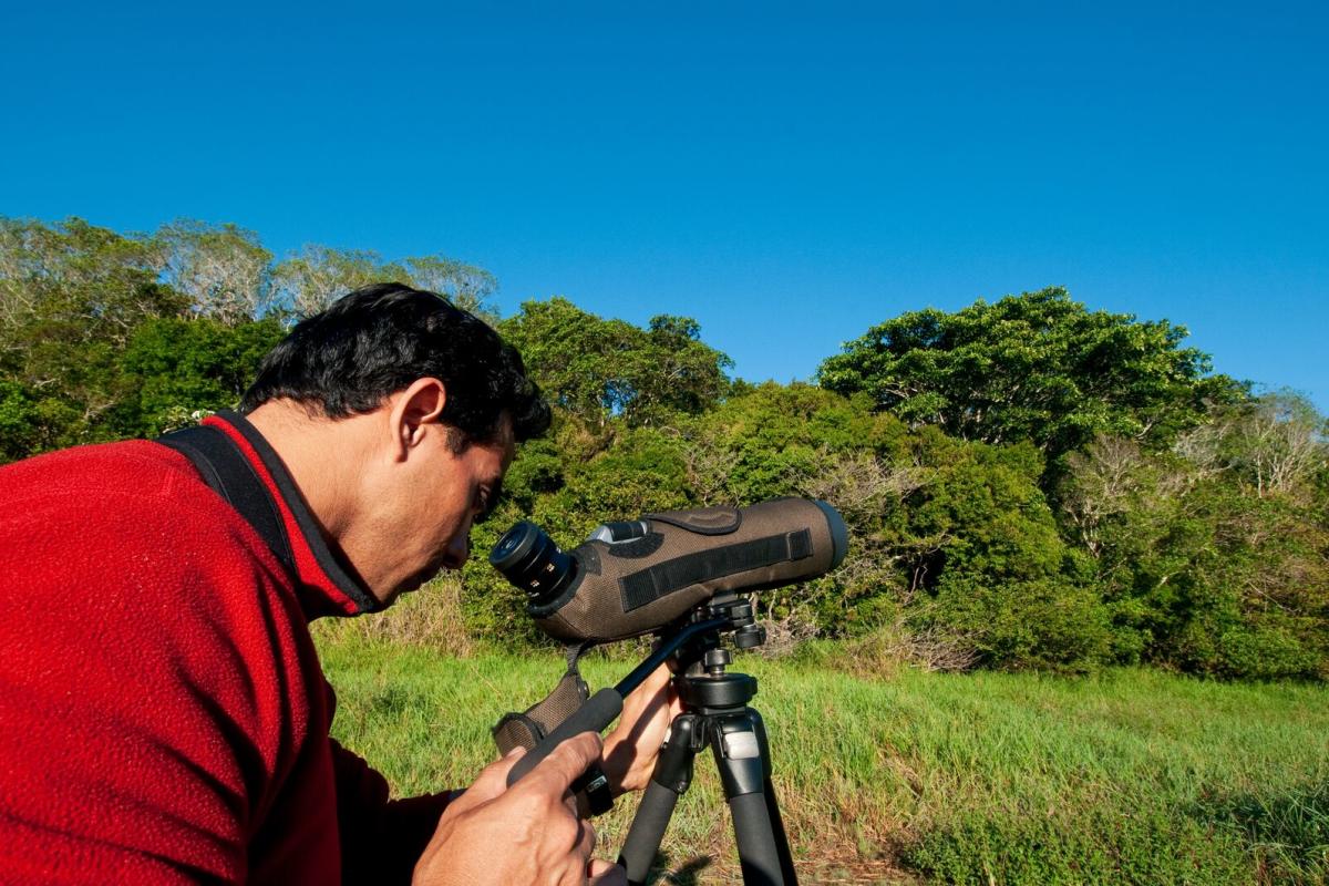
3. If you love birdwatching, simply stay at the top of the canyon—more than 300 species live here. This hotspot is easily accessible and requires little physical effort, making it ideal if you have reduced mobility.
Tip
Always go with an expert guide who will provide the necessary equipment—ropes, harnesses, and helmets. Always ask about the weather conditions; during the green season, flash floods may occur, and entry is not allowed for safety reasons.
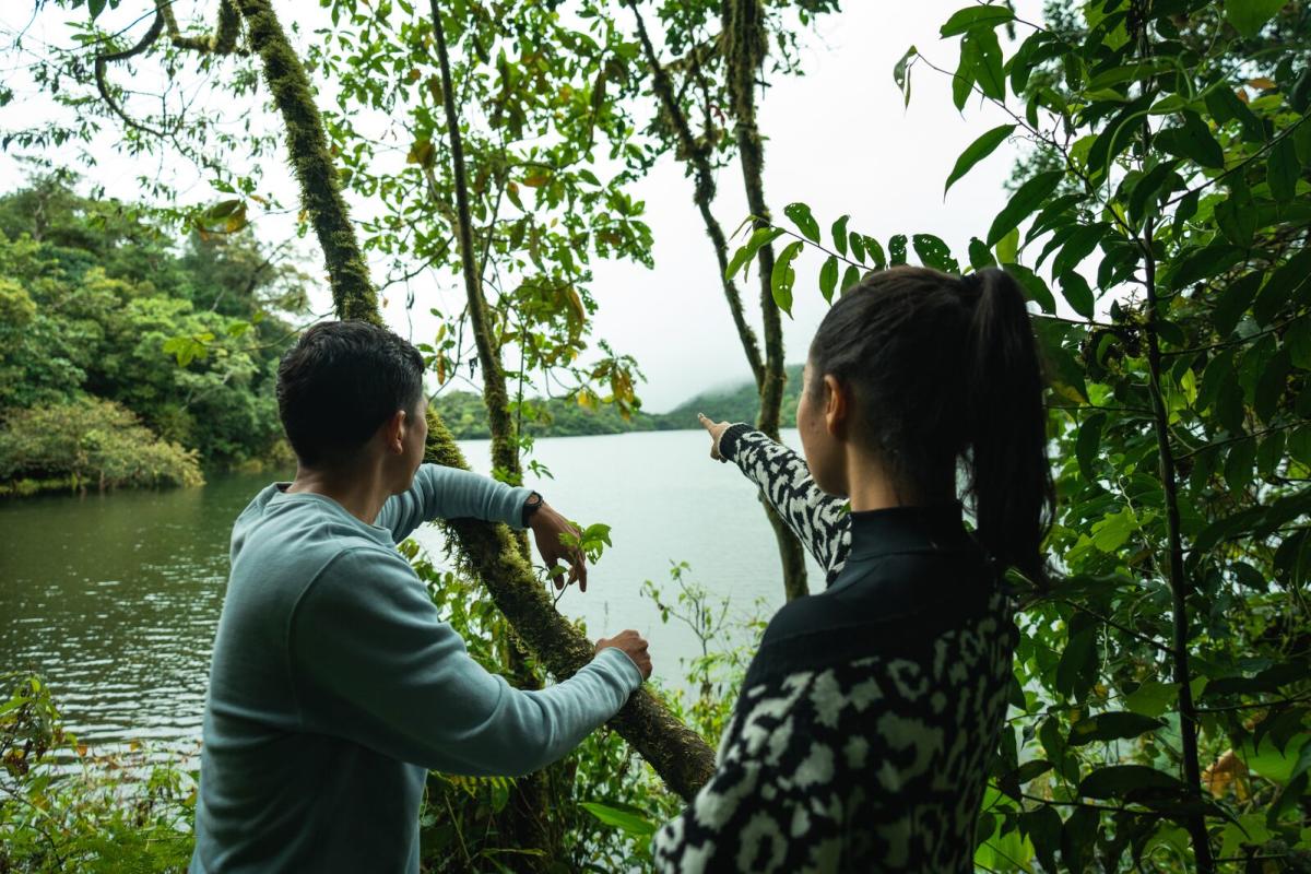
The Volcan lagoons are part of a biodiverse wetland. Although the lagoons lie within private farms, the 143‑hectare wetland is a protected area with public access. Start your walk in the valley and finish in a secondary forest, where you’ll find an immense variety of flora and fauna.
Visit early in the morning to hear the more than 425 species of native and migratory birds that come to this area.
Tip
This experience is a bit different from the others because most of the walk takes place in a valley. There is very little shade, so protect yourself from the sun and bring plenty of water.
While you can explore the lagoons on your own, the area is of great natural value and worth visiting with a specialized guide who can teach you about local flora and fauna, help you spot birds, and even offer medicinal plant tours.
10. From Finca Guardia to Salto del Tigre Waterfall
- Location: Volcan Baru National Park
- Distance: 4 km (2.48 miles)
- Difficulty: Moderate
Enjoy a different kind of morning on this route that combines forest, mountain, valley, farmlands, and rural landscapes. A very curious element of this trail is that, in addition to diverse flora, you’ll see farm animals such as cows, horses, and donkeys. Of course, in the midst of so much greenery, you may also encounter wildlife like squirrels, monkeys, and many bird species—especially hummingbirds.
The waterfall, with a drop of around 25 m (82 ft), will leave you fully recharged.
At the waterfall, you can enjoy a picnic, connect with nature, and for the bravest, take a quick dip in the icy clear waters at the base.
Tip
Start early in the morning to enjoy better conditions, spot more wildlife, and return by midday to continue your adventures.
11. Salto Cabello de Angel Waterfall
- Location: Volcan Baru National Park
- Distance: 2.5 km (1.55 miles)
- Difficulty: High
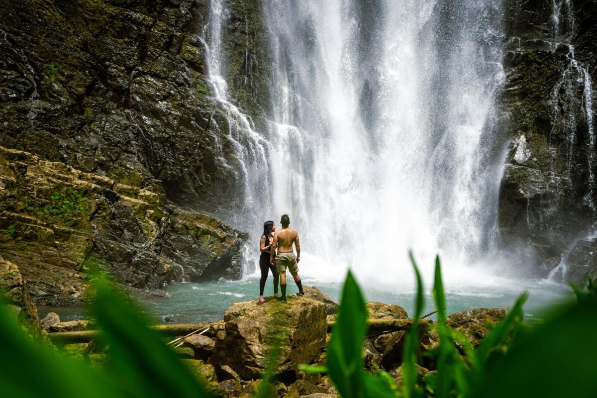
You’ll see this massive waterfall from the Breñon road—its height will take your breath away. The drop is so striking that many adventurers have asked permission from the surrounding private farms to find the riverside path that leads to its stunning lagoon.
From below, the waterfall seems to disappear into the clouds. At its fullest, you can see up to four streams cascading down. It stands 35 meters high and has a beautiful lagoon at its base. The best part of the adventure is jumping from the rocks into the cold water for a thrilling dip.
Tip
The route begins on private property. From there, you can follow a small path used by the landowners or walk through the pine trees. The descent is not well marked, so it’s essential to go with someone who knows the way.
Walk beneath the forest and above the clouds—discover unparalleled landscapes and bathe in cold, crystal‑clear waterfalls. To experience wildlife at its fullest, always take advantage of the early morning. Wake up at sunrise, enjoy a delicious cup of local coffee, and begin your adventure.
Tierras Altas
Where to Stay in
