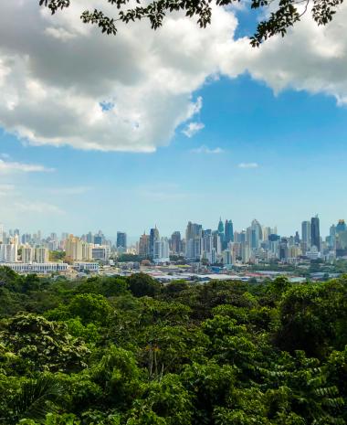


Surrounded by national parks and green lungs, Panama City offers the perfect contrast between modernity and wild nature.
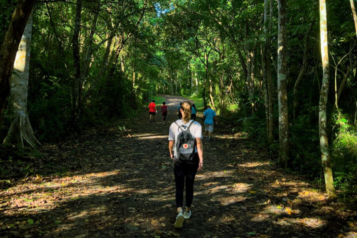
Without straying far from your hotel, the historic sites, or delicious restaurants, you can walk and hike in Panamá through the tropical forest and discover the city’s greenest side. Get ready to explore 11 incredible trails in Panama City.
1. Momotides Trail: The Jungle Within Reach
2. Los Caobos – El Roble Circuit: Among Giants
3. La Cienaguita – Mono Titi and Cerro Cedro Circuit: 360º Viewpoint
4. Cerro Ancon Trail: The Iconic One
6. Panama Rainforest Discovery Center: From Above
7. Plantation Trail: A Path to Fall in Love With
8. Camino de Cruces: History and Nature
9. El Charco: For the Whole Family
10. Cerro Jefe Trail: Among the Clouds
11. Tropical Rainforest and the Chagres River: A Return to Origins
1. Momotides Trail: The Jungle Within Reach
- Location: Metropolitan Natural Park
- Distance: 1 km (0.62 miles)
- Difficulty: Easy
This is a family‑friendly trail through the tropical forest. The path is relatively flat and easy to access—an ideal option for hiking near the city. Along the route you may spot animals such as the Geoffroy’s tamarin, agoutis, squirrels, butterflies, and many more.
Look for the Whooping Motmot (Momotus subrufescens), the bird that gives the trail its name, along with many other species that fly through the area. It’s an ideal trail for birdwatching.
Tip
This trail has good signage, so you can explore it on your own or request a park guide, who will take your experience to the next level.
The Metropolitan Natural Park is open daily from 7:00 a.m. to 4:30 p.m.
2. Los Caobos – El Roble Circuit: Among Giants
- Location: Metropolitan Natural Park
- Distance: 1.45 km (0.9 miles)
- Difficulty: Moderate
This circuit combines two trails that you can complete in a single visit or choose individually. Since both are inside the Metropolitan Natural Park, they’re perfect options for hiking close to the city.
Start from the visitor center on the Los Caobos trail, named after the large mahogany tree you’ll encounter along the way. This path covers 0.9 km (0.56 miles) and leads to an overlook where you can view the city framed by greenery—one of the park’s favorite views.
Continue for 0.7 km (0.43 miles) until you reach the intersection with the El Roble trail. There you can choose to return or complete the full circuit. On this part of the route you’ll see even more wildlife and vegetation, and you’ll pass the Jicotea pond, home to turtles, carp and other small creatures.
Tip
To walk the circuit or either trail, keep in mind that the park is open daily from 7:00 a.m. to 4:30 p.m. Entrance fees range from approximately US$1 to US$5.
3. La Cienaguita – Mono Titi and Cerro Cedro Circuit: 360º Viewpoint
- Location: Metropolitan Natural Park
- Distance: 2.8 km (1.74 miles)
- Difficulty: Moderate
This circuit takes you deeper into the forest and includes a climb to Cerro Cedro, perfect for a great hiking experience in Panamá. From here, you’ll enjoy a 360º view of the city and its main landmarks.
Start on the La Cienaguita trail: 1.1 km (0.68 miles) uphill through dense forest, massive trees, and abundant flora and fauna. The trail ends at the intersection with the Mono Tití Trail. From here, you can climb to Cerro Cedro, the highest point in the park at 156 meters (511.81 feet), and capture incredible photos of the city.
Continue along the Mono Tití Trail in search of these tiny, curious monkeys until you reach the Los Trinos viewpoint. From this overlook, you’ll see deep into the forest—an ideal moment for birdwatching and possibly spotting local mammals.
Tip
Do not get too close to the animals or try to feed them. This is wild fauna and should not be disturbed.
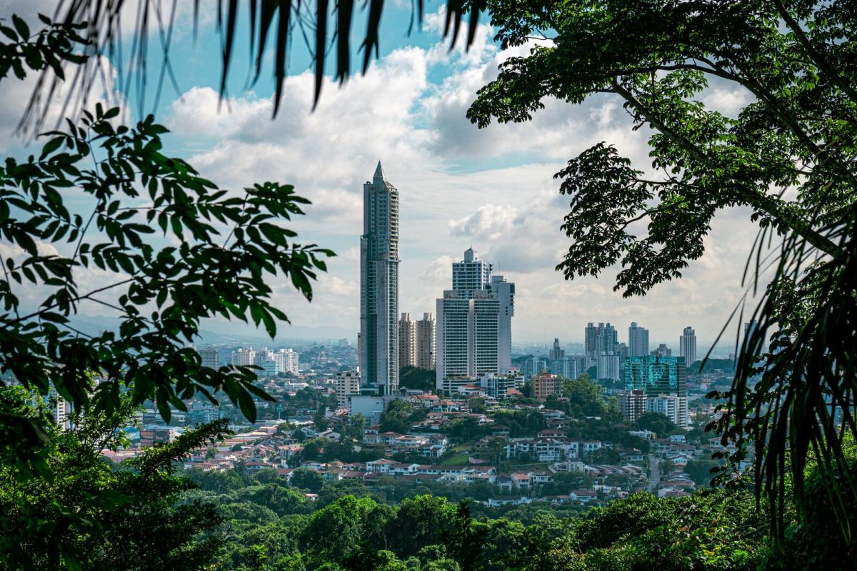
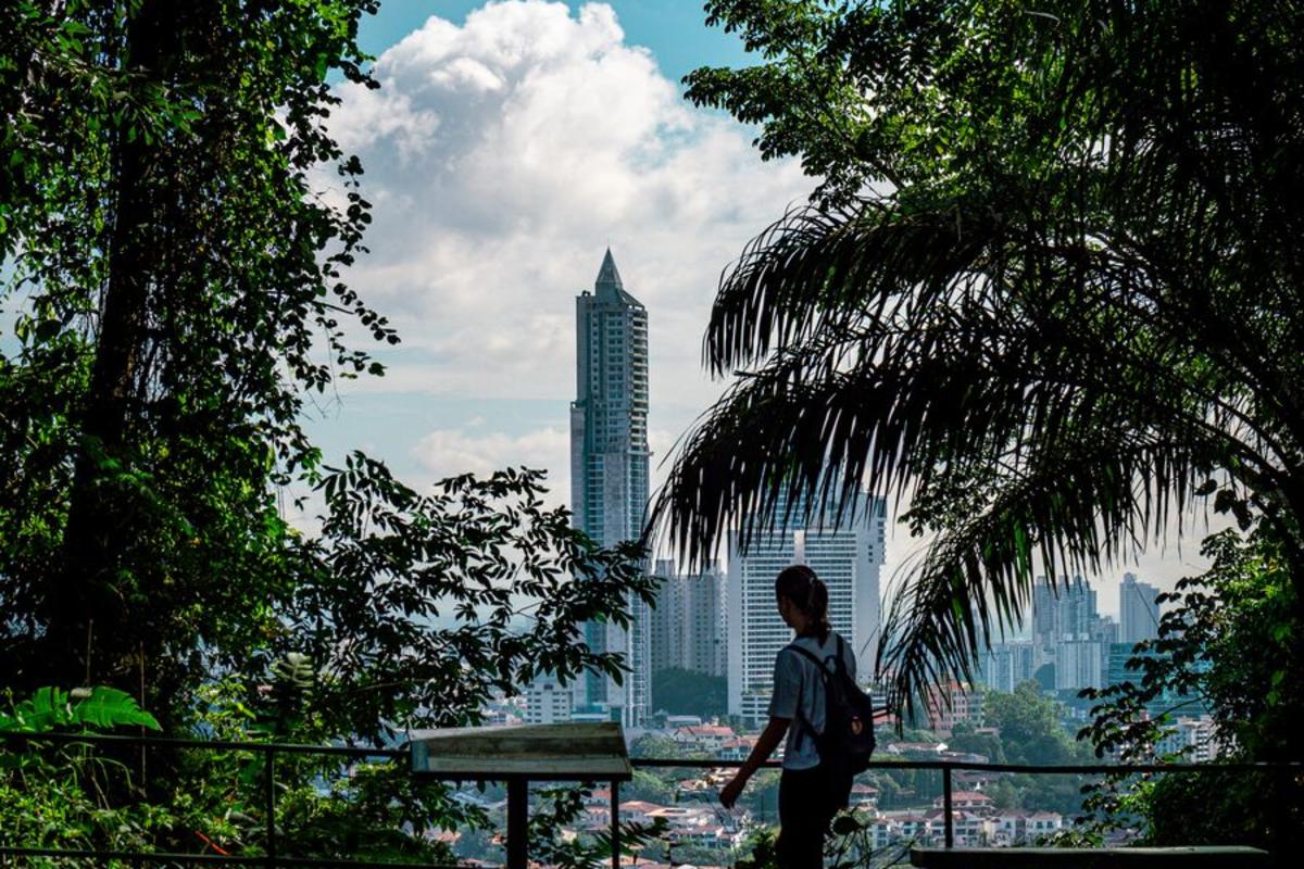
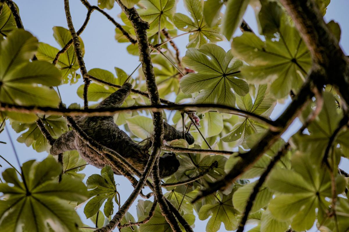
4. Cerro Ancon Trail: The Iconic One
- Location: Ancon District
- Distance: 2 km (1.24 miles)
- Difficulty: Easy
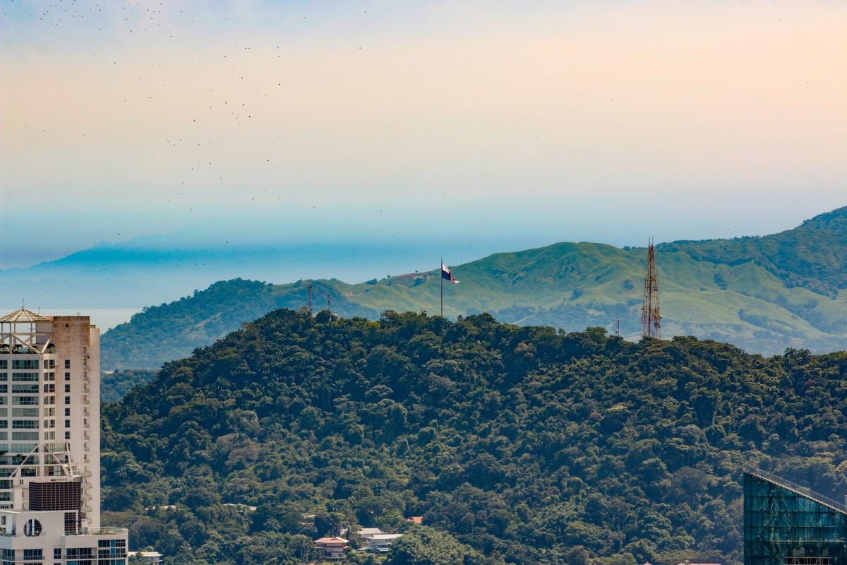
Cerro Ancon is a symbol of national sovereignty. At its peak flies a massive Panamanian flag, visible from many places in the capital.
This 120‑meter (393‑foot) ascent follows a wide concrete road that circles the hill to the top. Cerro Ancon is part of a municipal circuit of protected areas that aim to conserve the forests near the Canal. Along the way, you may spot 260 plant species and some of the 70 registered wildlife species, including sloths, agouti families, and monkeys. Early in the morning, you may encounter deer and armadillos, hear dozens of birds singing, and watch colorful butterflies fly by.
At the summit, you’ll enjoy beautiful panoramic photos of the city. Look for Casco Antiguo, the modern skyline, the ruins of Panamá Viejo, the famed Panama train, and the Balboa port. Truly an extraordinary reward for hiking so close to the city.
5. Pipeline Road
- Location: Soberania National Park
- Distance: 23 km (14.29 miles)
- Difficulty: Easy to hard
This trail is known as the park’s gem. Up to 525 bird species have been observed here in a single day. The path is long and partly covered by the dense jungle surrounding it, which is why most visitors choose shorter segments in the most popular sections.
Some of these areas include the lagoon zone, Pipeline In, and Pipeline Out. Here you may observe howler, white‑faced, capuchin, and tamarin monkeys, as well as anteaters, capybaras, red‑tailed squirrels, sloths, and many more animals.
Tip
Many tour operators include parts of Pipeline Road in their birdwatching itineraries. With their guidance, you can choose the segment that best suits your fitness level—whether you want something easy or a more demanding adventure.
6. Panama Rainforest Discovery Center: From Above
- Location: Soberania National Park
- Distance: 175 steps
- Difficulty: Moderate
This trekking experience is unique because it’s not a typical trail. You’ll climb a 175‑step tower to reach an incredible birdwatching viewpoint.
From the top, look for species such as different types of herons, the great kiskadee (Pitangus sulphuratus), purple gallinules (Porphyrio martinica), and common gallinules (Porphyrio chloropus).
If you prefer not to climb, you can still see up to eight hummingbird species at the base of the tower, near the pond and feeders. Try spotting the long‑billed hermit (Phaethornis longirostris), white‑necked jacobin (Florisuga mellivora), rufous‑crested coquette (Lophornis delattrei), Buffon’s plumeteer (Chalybura buffonii), blue‑chested hummingbird (Amazilia amabilis), golden‑tailed sapphire (Amazilia edward), and rufous‑tailed hummingbird (Amazilia tzacatl).
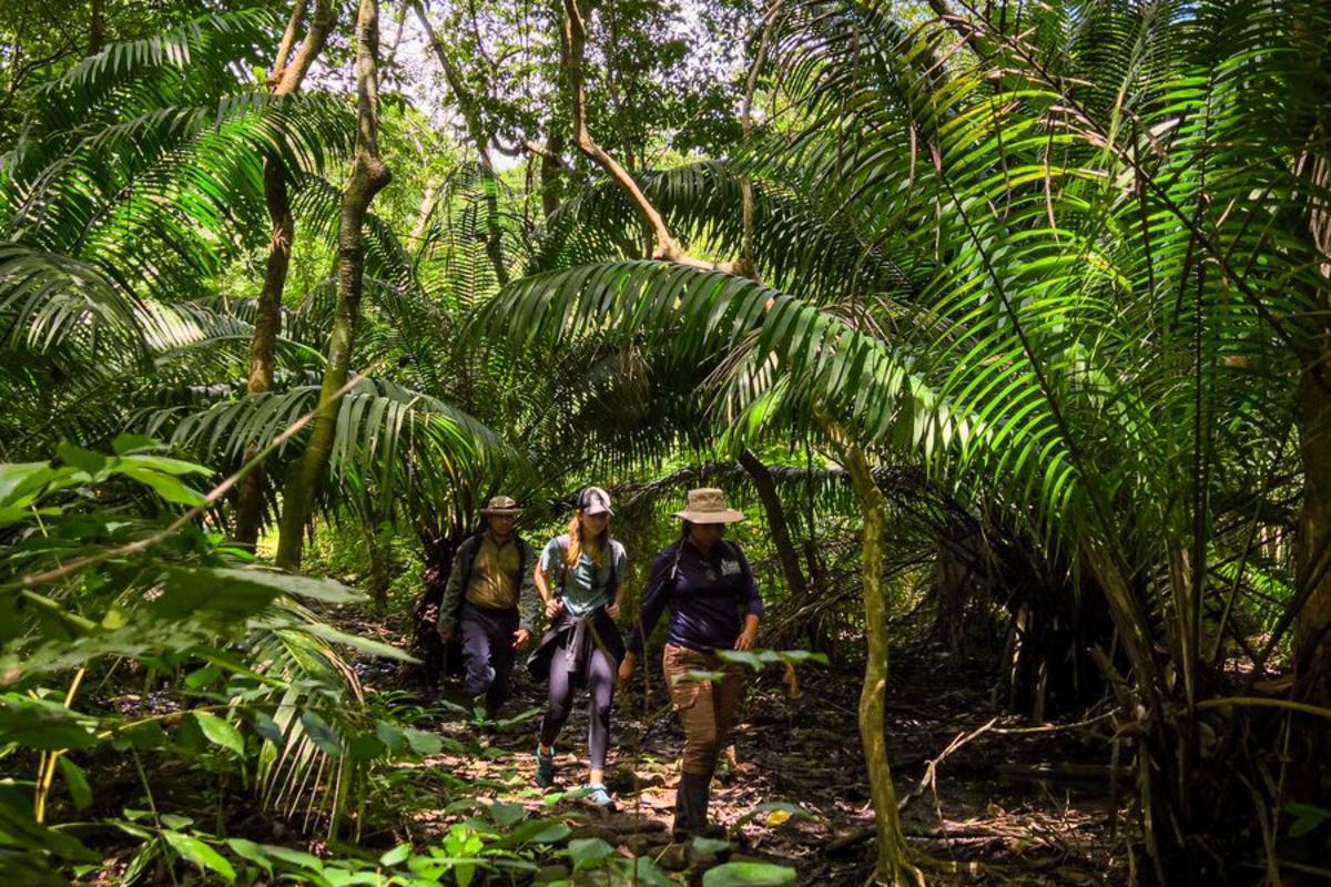
7. Plantation Trail: A Path to Fall in Love With
- Location: Soberania National Park
- Distance: 6.5 km (4 miles)
- Difficulty: Easy to moderate
This trail takes you through mature, open forest—perfect for spotting mammals and a wide variety of birds. The hike is peaceful due to its gentle slopes. The trail follows a beautiful stream and leads to small waterfalls embedded in natural scenery.
Tip
For a more extreme adventure, this trail connects to Camino de Cruces, allowing for a much longer hike. It’s recommended to go with a guide who knows the route and can teach you about the flora and fauna along the way.
8. Camino de Cruces: History and Nature
- Location: Soberania National Park
- Distance: 10.8 km (6.71 miles)
- Difficulty: Moderate
This path—one of the oldest trade routes in Panamá—is part of the Transisthmian Colonial Route, declared a UNESCO World Cultural Heritage Site. On the remaining original stone segments, you’ll walk through a lively natural forest. Throughout the hike you must cross several streams; depending on the season, the water may reach your ankles or calves, but no higher.
The first half is quite uneven, while the second offers gentler slopes. At the midpoint (4.1 km / 2.54 miles), you’ll reach the intersection with the Plantation Trail. There, you can return via Plantation, go back the way you came, or continue to the end where the trail meets the Chagres River.
Tip
This trail should be done with a guide, especially if you want to reach the end.
If your plan is to arrive at the Chagres River, you must prearrange with a boatman to wait for you and return you to the road. If you want to combine this route with the Plantation Trail, your guide will arrange the return to the starting point.
The best time to visit this trail is from December to March, when there is less rain and the path is easier to navigate.
9. El Charco: For the Whole Family
- Location: Soberania National Park
- Distance: 0.8 km (0.50 miles)
- Difficulty: Easy
The highlight of this trail is a picnic area facing a beautiful waterfall and a refreshing natural pool. El Charco is divided into two routes: a short path and the full circuit. The short path is about 200 meters from the entrance booth to the pool—perfect for all ages and even for people with reduced mobility.
The longer 0.8 km (0.50 miles) circuit is still easy but requires a bit more effort. The trail follows the Sardinilla River, includes a small ascent, and crosses hanging bridges that make the experience fun. In the tropical forest, you may encounter howler monkeys, tamanduas, sloths, agoutis, and many more species. You’ll also see toucans, woodpeckers, iguanas, and blue morpho butterflies.
Tip
The best time to visit is during the green season, from March to December, when the pool and waterfall are at their best—and you can even swim. Bring a picnic basket and remember to leave everything as you found it.
10. Cerro Jefe Trail: Among the Clouds
- Location: Chagres National Park, Cerro Azul
- Distance: 14 km (8.69 miles)
- Difficulty: Easy to moderate
This trail crosses a dwarf forest and cloud‑covered hills in one of the coolest areas near the city. At the summit of Cerro Jefe, you’ll be at 1,007 meters (3,303 feet), with incredible views of the Panama Canal for perfect photos.
Here, 114 mammal species have been recorded—including tapirs, white‑tailed deer, spider monkeys, and five species of big cats. There are around 396 bird species and 96 reptiles as well.
Tip
Since this is one of the coolest areas near the capital, mornings are the best time to start the hike, as skies are clearer. In the afternoon, fog rolls in and temperatures drop. Bring a light jacket and, as always, go with a guide.
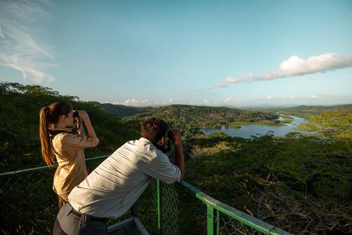
11. Tropical Rainforest and the Chagres River: A Return to Origins
- Location: Chagres National Park, Emberá community
- Distance: 1.5 km (0.93 miles)
- Difficulty: Moderate
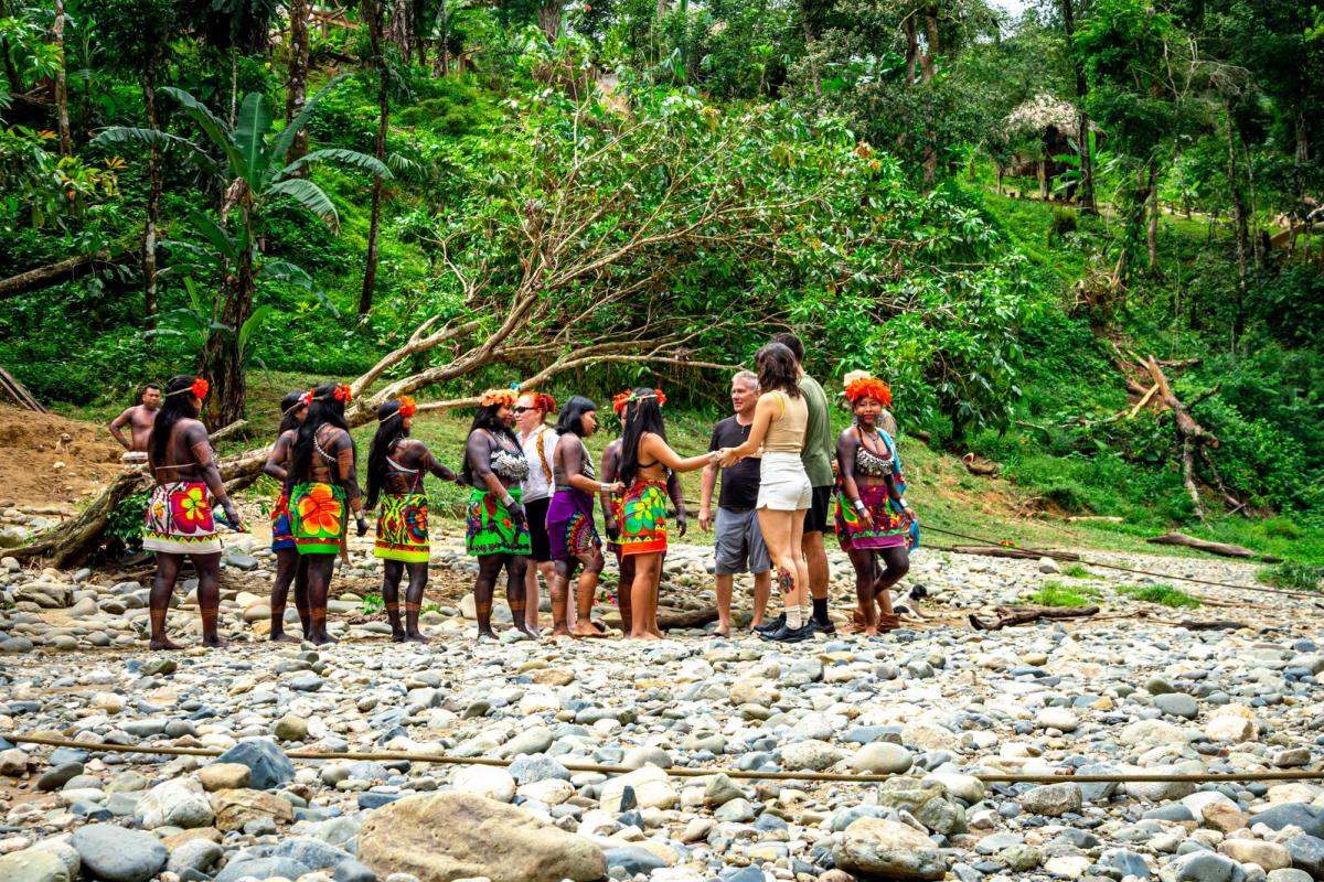
The best way to explore this park is through a community‑based tourism experience guided by members of the Emberá community who inhabit this territory. They welcome you and share, in their own words, their home, daily life, and cultural worldview.
The tour begins with a traditional canoe ride on the Chagres River, followed by a 30‑minute hike to a waterfall where you can swim in nature. At the end, you’ll arrive at the community center, where they share their history, traditions, and beliefs.
The Emberá community relies solely on community tourism and has created a complete experience: traditional dances, local cuisine, and handicraft demonstrations—items you can also purchase as handmade souvenirs.
Beyond unforgettable moments, you’ll gain something even more valuable: a respectful, genuine connection with an Indigenous community, directly from those who live it. By participating, you also support the local economy of an organized community that warmly opens its doors to share with visitors.
Tip
The cost of the full tour varies depending on the number of people and the level of personalization. As of early 2026, the average cost is US$119 and it lasts approximately 7 hours.
Wear comfortable clothing, a swimsuit, and bring a change of clothes.
Panama City
Where to stay in
