


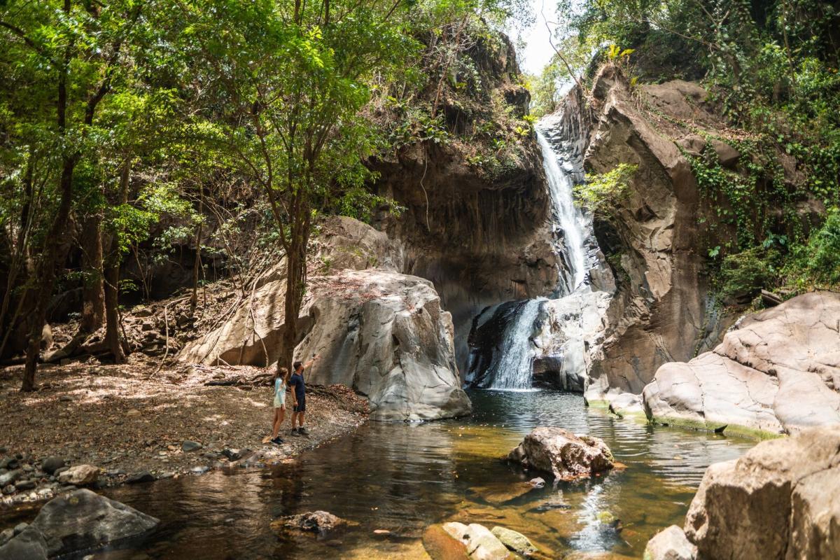
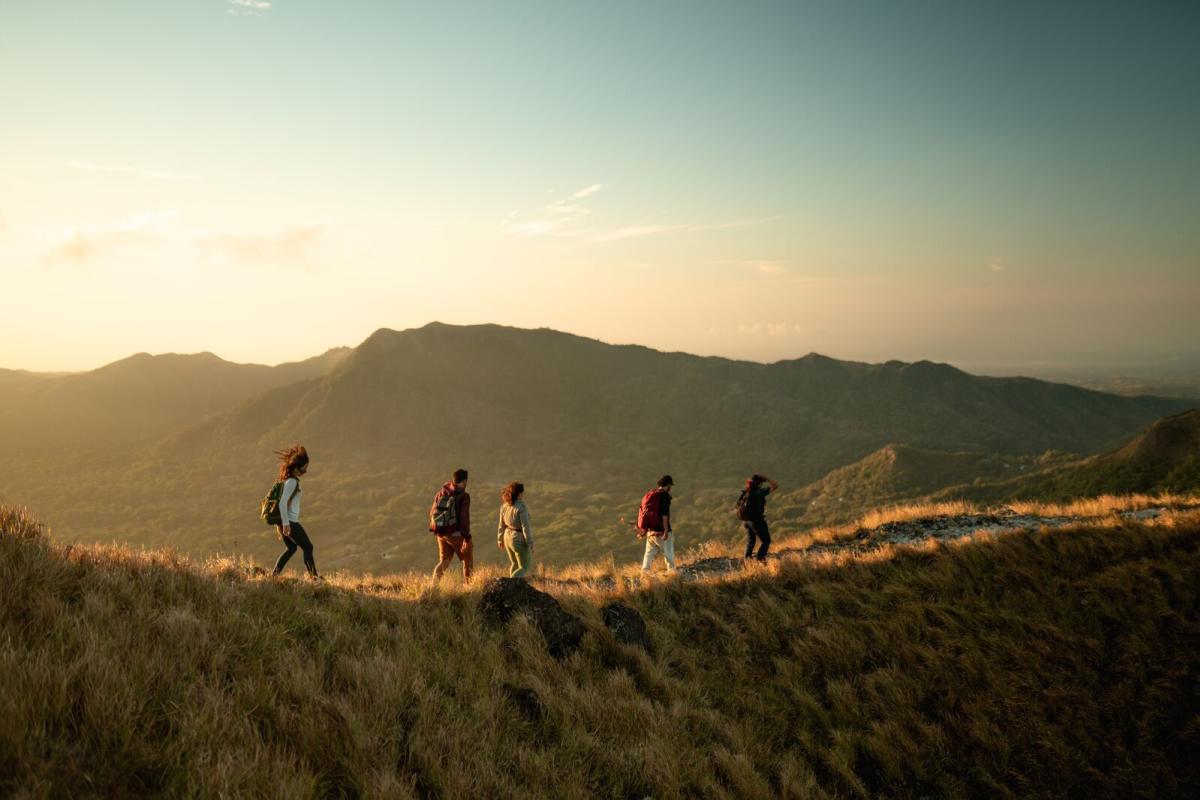
During your next vacation in Panamá’s Pacific Riviera, take some time to change the scenery. Step away from its amazing beaches for a moment and look toward the mountains to discover the best hiking in Panamá… There, surrounded by lush greenery, the Riviera hides its greatest secret: the best trails in the Pacific Riviera and waterfalls that flow through the forest.
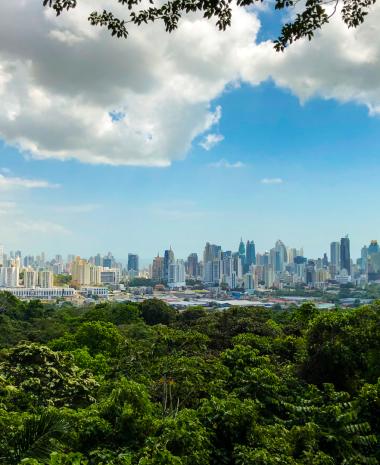
Not far from Panama City, the Pacific Riviera is the ideal destination for your next adventure-filled trip. This destination combines an extensive beach corridor with hotels, rental homes, and resorts for all preferences.
Here are 10 places to discover the greenest and wildest side of the Pacific Riviera.
1. La Cruz Trail
- Location: Altos de Campana National Park, Panama Oeste
- Distance: 1.3 km one way (0.8 miles)
- Difficulty: Moderate
Although it’s a short hike, there are steep sections that require effort. From the cross viewpoint, you’ll enjoy a spectacular view of the exact spot where the Chame River meets the Pacific Ocean and the incredible mountain scenery.
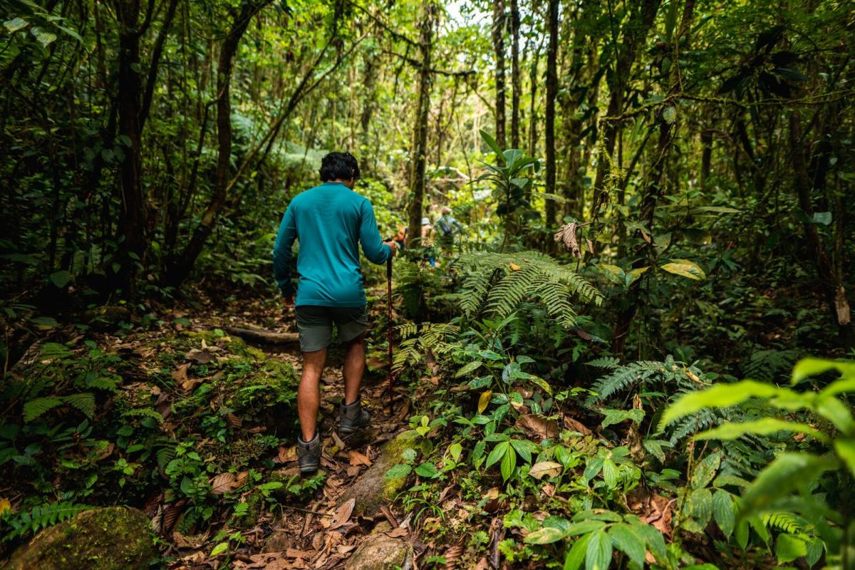
Before reaching the top, you’ll cross small streams and watch the landscape and vegetation gradually change. The most spectacular part? The humid forest is full of moss, bromeliads, and orchids.
To get there, take a detour at km 60 of the Pan-American Highway. A sign reading “Loma de Campana” will guide you to the park’s parking area.
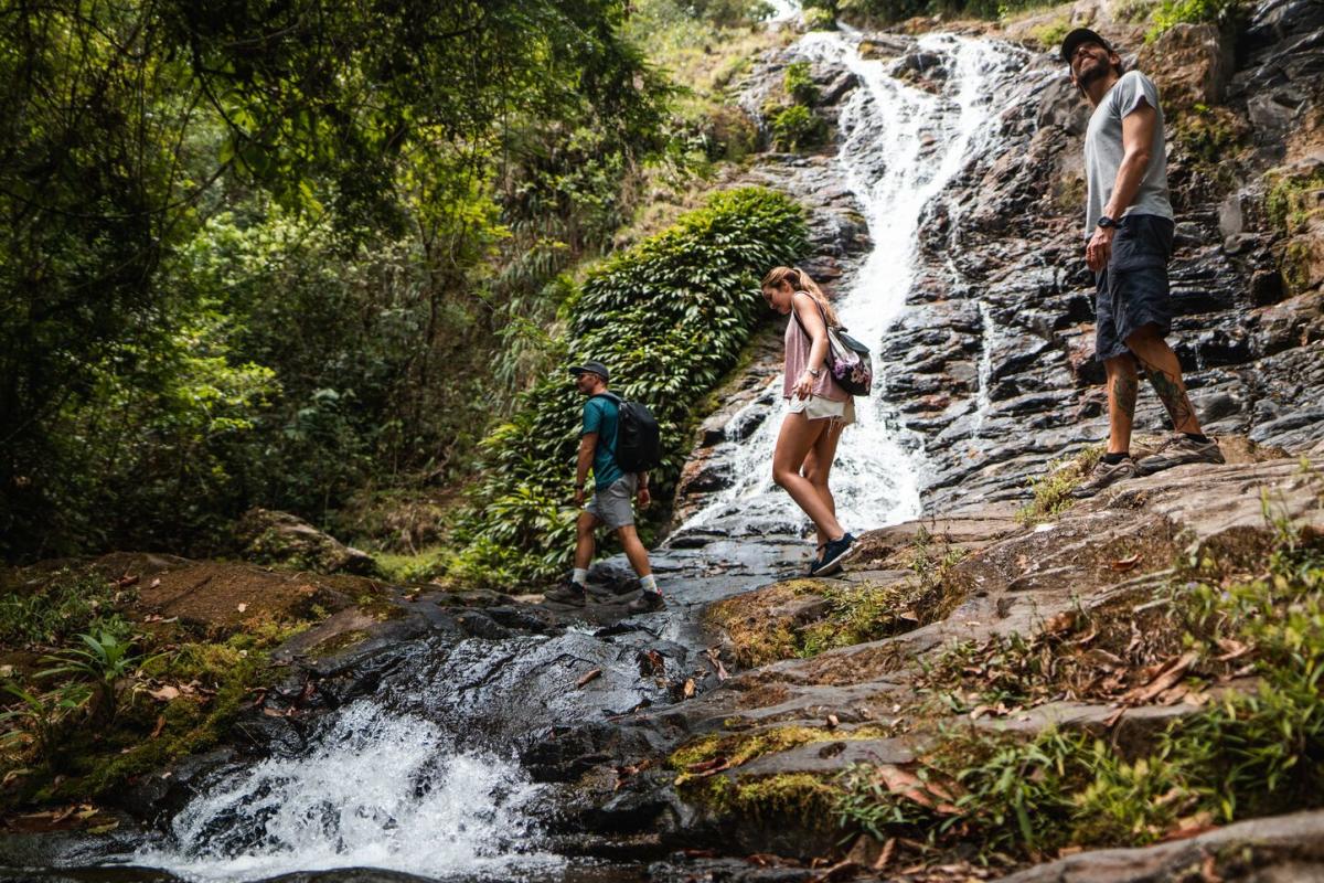
Tip: Hiring a guide is essential for hiking in Panamá and ensuring a safe route. Expert guides can also help you identify species and teach you about the area’s biodiversity.
2. El Manglarito Waterfall
- Location: Sora, Chame
- Distance: 3 km (1.86 miles)
- Difficulty: Low
Known as the jewel of Manglarito town, this waterfall is a hidden treasure. To get there, you can hire a pickup truck near the police station—where adventurers gather to start their day. Get ready for a fun ride that helps you pass the toughest sections.
A short and easy descent of about 10 minutes awaits you at the end—just watch your step to avoid slipping. You’ll arrive at the top of the waterfall, where you’ll have an incredible panoramic view. Then you can climb down the rocks to the lagoon, perfect for swimming against the current and cooling off in the water and wind.
Tip: Travel with an expert guide who can advise when it’s safe to enter and exit the water, especially during the rainy season.
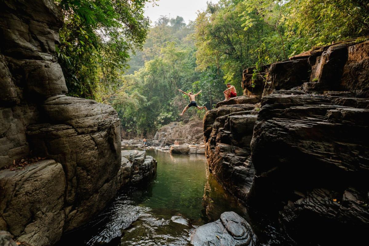
3. Saca Lagrimas Waterfall
- Location: Buenavista Chica, West Panama
- Distance: 8.58 km (5.33 miles)
- Difficulty: High
Adventure tourism will take you to many waterfalls in Panamá, but reaching this one is a challenge—its name “Saca Lágrimas” (“Tear-jerker”) humorously reflects the effort needed to reach your reward.
Expect steep climbs and descents, river crossings, and narrow sections that add adrenaline. The final 45-meter (147-foot) drop is breathtaking.
If you climb to the top, you’ll find more waterfalls, including one that forms a small pool before dropping.
It’s not a safe place to swim, but it is perfect for appreciating nature and capturing dramatic photos. Further down the trail, you’ll find better swimming spots.
Tip: Don’t skip the famous Charco El Duende for the full experience.
4. La Gloria Waterfall
- Location: Capira, West Panama
- Distance: 800 m (0.5 miles)
- Difficulty: Low
The trail follows the border between Panama Oeste province and the Panama Canal basin.
The meeting point is the house of Mr. Aníbal, well-known to local guides. The first section is easy and perfect for spotting endemic orchids and birdwatching. The trail leads to the top of the 87-meter (285-foot) waterfall—an unforgettable landscape.
The stepped structure is ideal for rappelling, so traveling with an expert guide and proper equipment is a must. Some visitors even climb up using the rocks. Dare to jump into the natural pools!
Since the trail crosses private land, hiring a local guide and bringing cash for small fees is necessary. For around US$2, you can use restrooms and changing rooms.
Tip: Nearby are other waterfalls with unique names like La Tulivieja and La Hija de la Tulivieja, which you can visit on the same tour.
5. Painted Rock to La India Dormida Hike
- Location: El Valle de Anton
- Distance: 1.66 km (1.03 miles)
- Difficulty: Medium
El Valle de Anton has the charm of a colorful mountain town and was named one of the “Best Tourism Villages” by the World Tourism Organization.
La India Dormida is the most iconic mountain—its silhouette resembles a reclining woman, inspiring local legends.
This trail is part of the Caldera Route, a nearly 30 km (18-mile) circuit around the crater. The section begins at Piedra Pintada, an archaeological site with ancient hand markings, and ends at the “head” of the India Dormida. It’s short and relatively easy with a few challenging climbs.
Tip: In the Valley, you can also book birdwatching and rappelling tours around India Dormida.
6. Caraiguana Hill Hike
- Location: El Valle de Anton
- Distance: 2 km (1.24 miles)
- Difficulty: Moderate
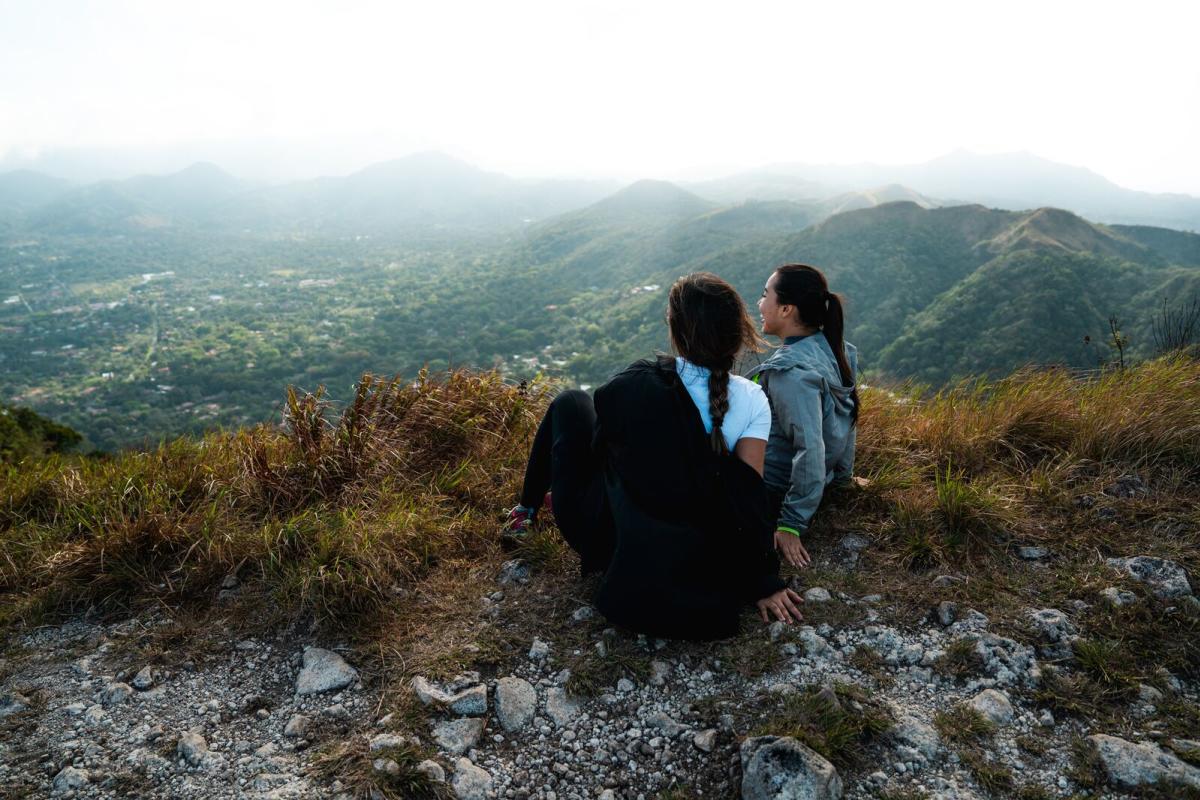
Part of the crater circuit, this hike leads to views of the town and the vast Pacific Ocean.
The first section can be done by car on a dirt road; the second—more beautiful—must be done on foot. Experts recommend going at sunrise or sunset for the best light.
Tip: This trail is part of the Caldera Route, so you can complete the full circuit in stages.
7. Cerro Gaital Hike
- Location: El Valle de Anton
- Distance: 2.48 km (1.5 miles)
- Difficulty: Low to Medium
Cerro Gaital is another section of the volcanic crater circuit.
The trail crosses a cloud forest covered in moss—ideal for birdwatching. At the summit, signs direct you to viewpoints where you can see both sides of the mountain, the town, and the Pacific Ocean. Some say that on a clear day, you can even glimpse the Caribbean Sea!
Tip: Due to its nature, Cerro Gaital is often covered in clouds, strong winds, or rain. This does not restrict access—just bring a windbreaker or waterproof clothing.
8. El Chorro Macho
- Location: La Mesa Road, El Valle de Anton
- Distance: 200 m (656 feet)
- Difficulty: Low
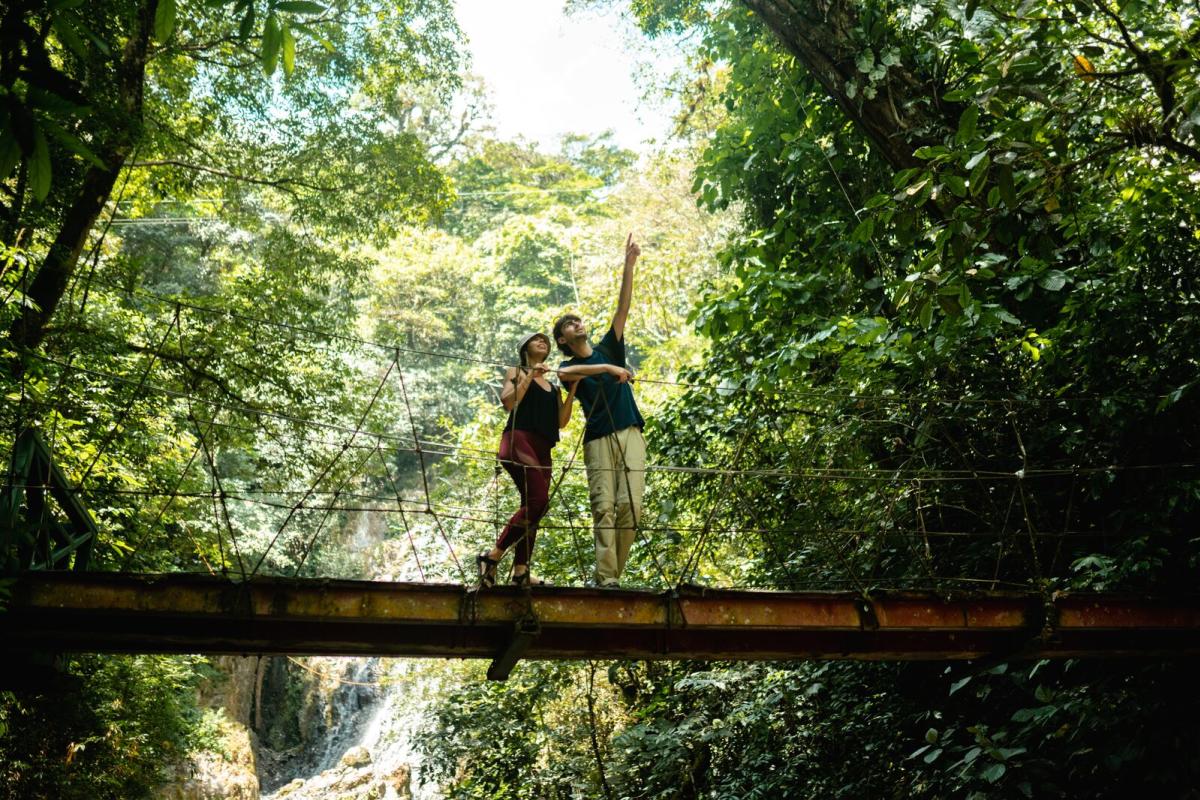
This stunning 35-meter (115-foot) waterfall sits inside an ecological reserve.
Two access options:
- an adrenaline-packed route with hanging bridges and ziplines
- a short, easy walk along wooden pathways and bridges
You can swim in natural pools. Prices range from US$5 to US$65 depending on the experience.
Tip: Best season: January–April (dry season). The rainy season means greener landscapes and stronger rivers—check conditions beforehand.
9. El Aguila Waterfall
- Location: El Valle de Anton
- Distance: 2.5 km (1.55 miles)
- Difficulty: High
Though not the tallest waterfall, it offers incredible views and a full day of adventure. A steep trail descends into the forest, followed by a riverside walk. Multiple streams fall into a natural pool—a perfect reward.
Beyond the main waterfall, the trail gets more difficult and includes rock climbing and more natural pools.
Tip: This trail is on private land—book a guide in advance.
10. Pozo Azul Waterfall
- Location: La Vieja Community, 1 hour from El Valle de Anton
- Distance: 200 m (656 feet)
- Difficulty: Low
Easy access with a US$2 entrance fee.
A short cement staircase leads to the stunning blue pool framed by green forest. You can jump from rocks, swim against the current, or climb to the top of the waterfall.
Tip: Open 8:00 a.m.–5:00 p.m., with a limit of 80 visitors per day. No services inside—just you and nature.
No matter the trail you choose, always hire a guide. This supports the local economy, keeps you safe, and prevents wasted time.
If you visit during the green season (April–December), follow local recommendations regarding weather and water safety.
Don’t miss the green side of the Riviera Pacifica—explore its tropical and cloud forests!
Riviera Pacifica
Where to Stay in
